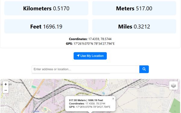
The estimated altitude (elevation) will be shown both above the map and on the map marker — in meters and feet.
You will also see the exact GPS coordinates (latitude and longitude) of the selected point.
Elevation values are based on digital elevation models (DEMs) and may vary from actual measurements.
Note: Elevation data may vary from actual ground measurements.
The chart shows elevation changes between selected points. Geolocation requires user permission.
Altitude vs Elevation
Elevation: It shows the height above sea level of a certain location on the Earth's
surface. Usually used for landforms such as cities or mountains.
Example: The elevation of Denver is approximately 5,280 feet above sea level.
Altitude: Height above the ground or sea level for a moving or airborne object. Altitude is
used for planes, drones, weather balloons, etc.
Example: A plane flying at 35,000 feet is at that altitude above sea
level.
Quick Comparison Between Elevation & Altitude:
Below is a quick comparison between elevation and altitude for better understanding.